
By Clarence Neese, Founder and Vice President, Orbis, Inc.
Land surveying played an essential role in the boundary development of the United States. Today, survey retracement re-establishes these boundaries in a digital format – and in a timely and cost-effective way for timberland investors. Let’s explore the history and evolution of land surveying and retracement.
What is Land Surveying?
Land surveying is the process of measuring a property’s dimensions.
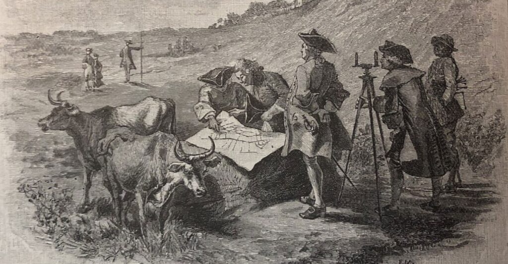
The United States was built on surveying. When the first colonists came to America, they brought surveyors with them to measure land for the Thirteen Colonies.
The Public Land Survey System
Nine years after America gained its independence in 1776, there was a land ordinance where Congress determined how the United States would be measured. Congress decided to measure the land in squares, known as the Public Land Survey System (PLSS).
“States like Kentucky, Virginia and Pennsylvania have funny shapes because they were measured using the colonial style of metes and bounds using bearings and distance techniques. But after that, the rest of the United States became a pattern of squares.”
The United States Founding Fathers were forward thinkers, knowing they had to measure the land in a way to encourage westward settlement.
How Did the United States Distribute the Land?
After measuring the states, the government assigned a certain number of squares of land to different people.
This was important in the United States because other countries did not assign land like this back then. Unlike other countries, America allowed for heavy land and ownership. In Colonial times, people could come to America, and the government would assign them land – so long as they were willing to go and establish that land.
That’s what the land grant was all about – how do we migrate across the United States? The government said: “We’re going to make squares, and you can assist the Land of Freedom and go get it.” So, if you wanted to go out West and get gold, you could do it under the charge of helping the United States establish itself. Pretty interesting!
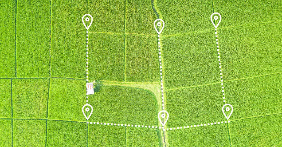
What is a Survey Retracement?
Survey retracement is the process of resurveying an existing boundary. Now, retracement is really only relevant to rural parts of the country, not big cities. Since Colonial times, cities like Atlanta, Charlotte and other urban areas have been built and resurveyed countless times.
When cities started putting houses side by side in the 1800s, a man was there on a horse to measure boundaries. So, for example, he would measure your ancestor’s lot, then when your grandparents wanted to build a house, there were probably plenty of arguments about where that lot was located. So, a surveyor was hired again. The same thing happens in every city every year because the land is so valuable.
Things are different in rural parts of the country. Orbis has client properties that haven’t been surveyed since the original surveys were done with a man on a horse. This person carried a 25-pound compass all over the place while avoiding lions, tigers and bears. That’s the reality of this situation.
“So, when I talk about retracement, it comes from the fact that the timberland industry is still based on these Colonial times and these Colonial measurements.”
Why Are Survey Retracements Important?
Now, with all of that being said, today’s modern surveying is unbelievable. What we do with satellites and measurements and sub-centimeter measurements of surveying is incredible, but it’s also expensive. If I wanted to survey your yard, it’s easy. But when you own a lot of land in the middle of the woods, and it hasn’t been resurveyed since colonial times, it’s very expensive and takes a lot of time. And it must be performed by a licensed surveyor.
When it comes to large land transactions, we don’t have that much time. I can’t wait for a land surveyor to survey 10,000 acres of land. It would take him three to six months – and more if it rained. It would cost thousands of dollars to resurvey a big property. So, we do a survey retracement where we try to follow in the footsteps of the original surveyor.

The Survey Retracement Process
Because Orbis is a licensed surveying company, we use modern technology GIS software and other software to go through the process of rereading what the original surveyor wrote down and putting that information into a modern GIS. We’re putting the historical information onto a map or into a digital format so that we can see how it overlays on satellite imagery, such as Google Earth or Google Maps, to make sure the original surveyor was right or to validate what was legally written back in those days.
I would do the same thing for a modern-day survey. I’d walk through the woods and stop and record a GPS to make a map. So, we’re eliminating the new survey and essentially just saying we trust what the guy on the horse did 200 years ago. We trust what the original surveyors did because it makes sense, it’s quick, and it’s easy.
Modern land transactions require proper due diligence and an understanding of where the exact boundaries and assets are located. That’s why Orbis combines a rigorous legal review with GIS-based mapping. It gives us a faster, more accurate due diligence solution that provides a visual and digital display of the assets. As a result, we’re able to reduce up to 95% of process errors and avoid any expensive surprises down the line.
Can You Replace an Old Survey with a New One?
It’s important to understand that, by law, you can’t just create a brand-new survey for land that has already been surveyed. So, if there’s already a survey there, you can’t come in and then say this is now the new survey. But what we can do is create a new survey that represents the old survey. And then we take that retracement survey and go back to see if there are any problems.
The Surveyor’s Intent
A lot of what we do in our survey retracement is trying to interpret the surveyor’s intent. It might not match perfectly because of modern technology and changes to the land. But the reality is we know what the surveyor’s intentions were. He was making the square: that was his intent. And so that’s a big part of our retracement processes.
Conclusion
Land surveying has a storied history in the United States. It was pivotal in establishing property boundaries during colonial times and beyond. And now, survey retracement helps to verify and digitize that boundary information in the 21st century.
Orbis Inc.’s land investment technical analysis service, LITAS, is a GIS-powered tool for the due diligence process of land transactions. Buying and selling land is a long road, but LITAS makes navigating the journey simple. Contact us today to learn more.

Let’s Work Together
Orbis helps you make better sense of your assets, and better use of everything involved in managing them. Request more information or book a consultation with us today.